
Riga Spring Legends rogaining
Regulations Programme How to get there & Event Centre Quiz CPs Map Legend
Legend of ĶĪPSALA AND ITS SURROUNDINGS
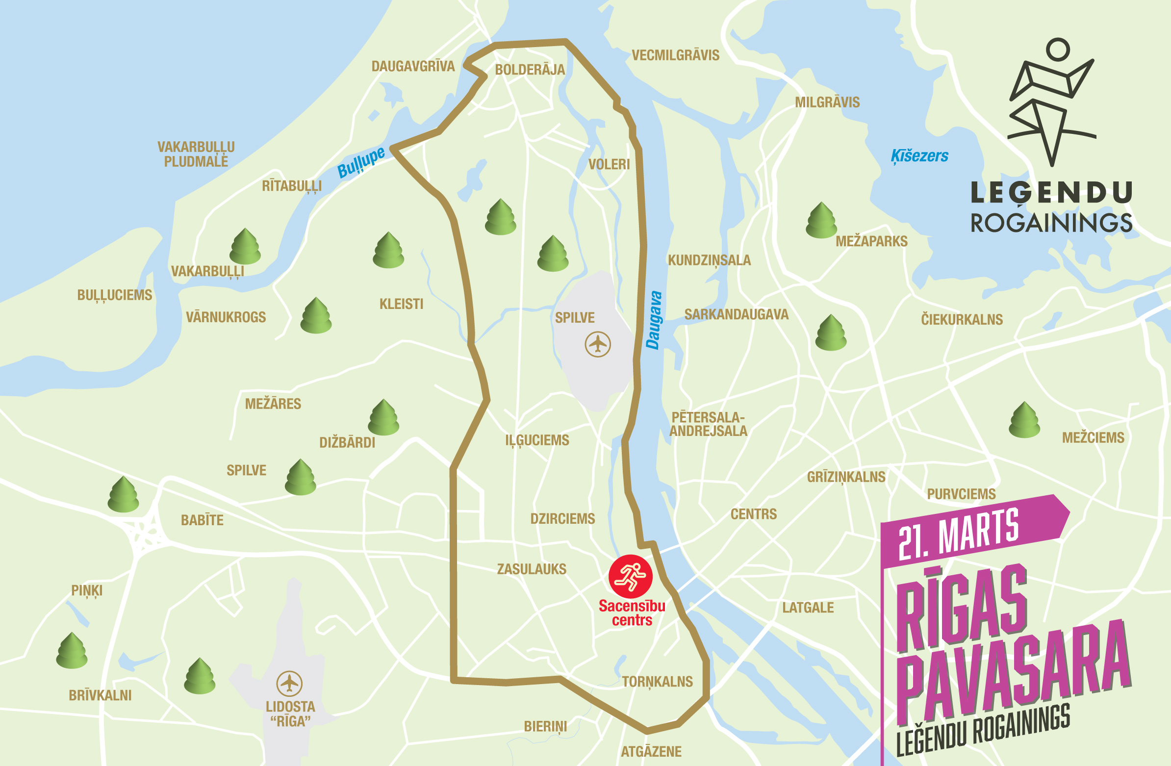
In the late 19th century, Ķīpsala was a quiet island on the Daugava riverbank with ship berths and craftsmen’s workshops, while Āgenskalns grew into a charming suburb of merchants and artisans with cobbled streets and wooden houses. Further out, the areas of Imanta and Iļģuciems were once meadows and scattered farmsteads before Soviet-era housing blocks, hidden shortcuts and courtyard labyrinths took over. During the Riga Legends Rogaining on 21.03.26, with the event centre located in Ķīpsala, participants will cross places where port history meets suburban charm, industrial heritage and the vibrant rhythm of modern Riga – running through more than a hundred years of city stories, from riverbanks to courtyard mazes.

Event Schedule and Programme
 Add to Google Calendar, or
 ![]() Add to Apple Calendar
Add to Apple Calendar
| Time | Activity |
|---|---|
| 09:30 | Number pickup and map distribution begins |
| 11:00 | Start of 6h rogaining (Rogaining hike participants may start anytime from 11:00 to 13:00) |
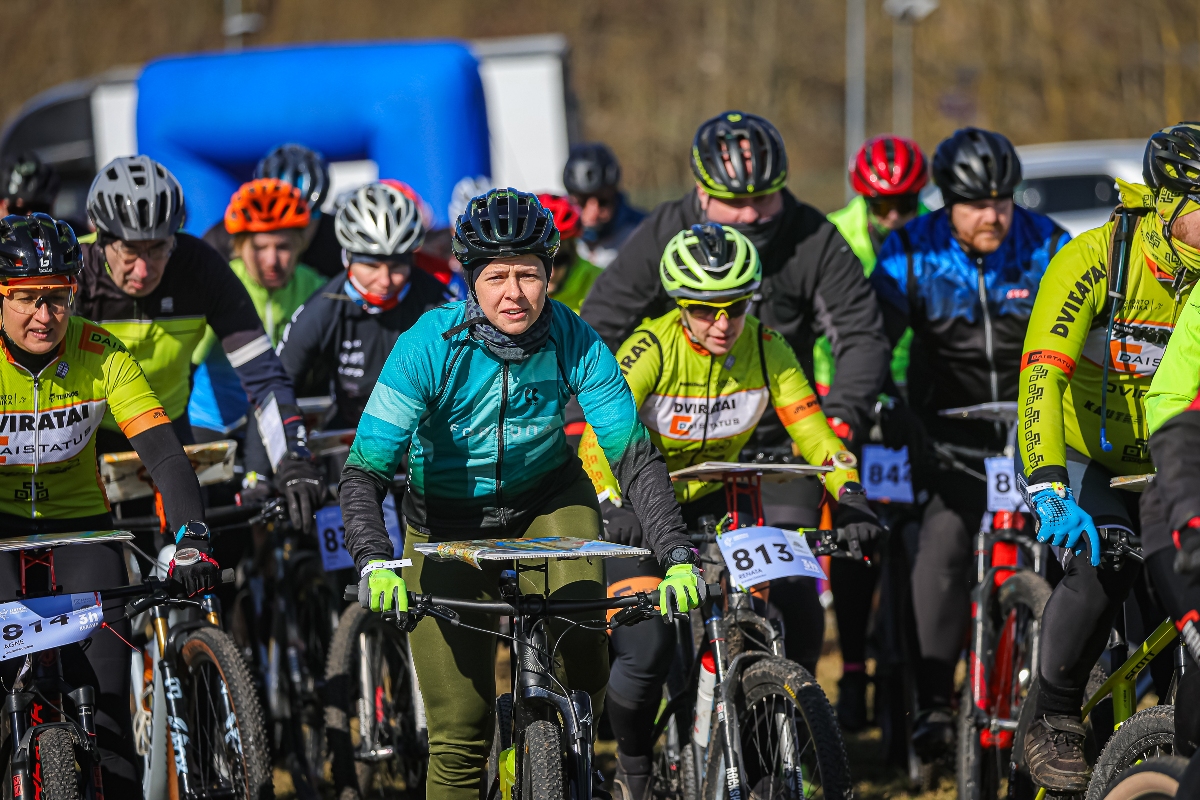
| 11:30 | Start of 3h MTB rogaining |
| 12:00 | Start of 4h rogaining |
| 13:00 | Start of 2h rogaining, 2h rogaining run and 2h rogaining hike |
| 14:30 | Finish time limit for 3h MTB rogaining |
| 15:00 | Finish time limit for 2h rogaining and 2h rogaining run |
| 16:00 | Finish time limit for 4h rogaining |
| 17:00 | Finish time limit for 6h rogaining and rogaining hike |
| 17:10 | Award ceremony for all distances and INTERVALS.LV lottery with Garmin and other prizes |
Event Centre Location and Terrain
The event will take place in Pārdaugava. The event centre will be located in near shopping center "Olimpia".
Directions to the event centre: 

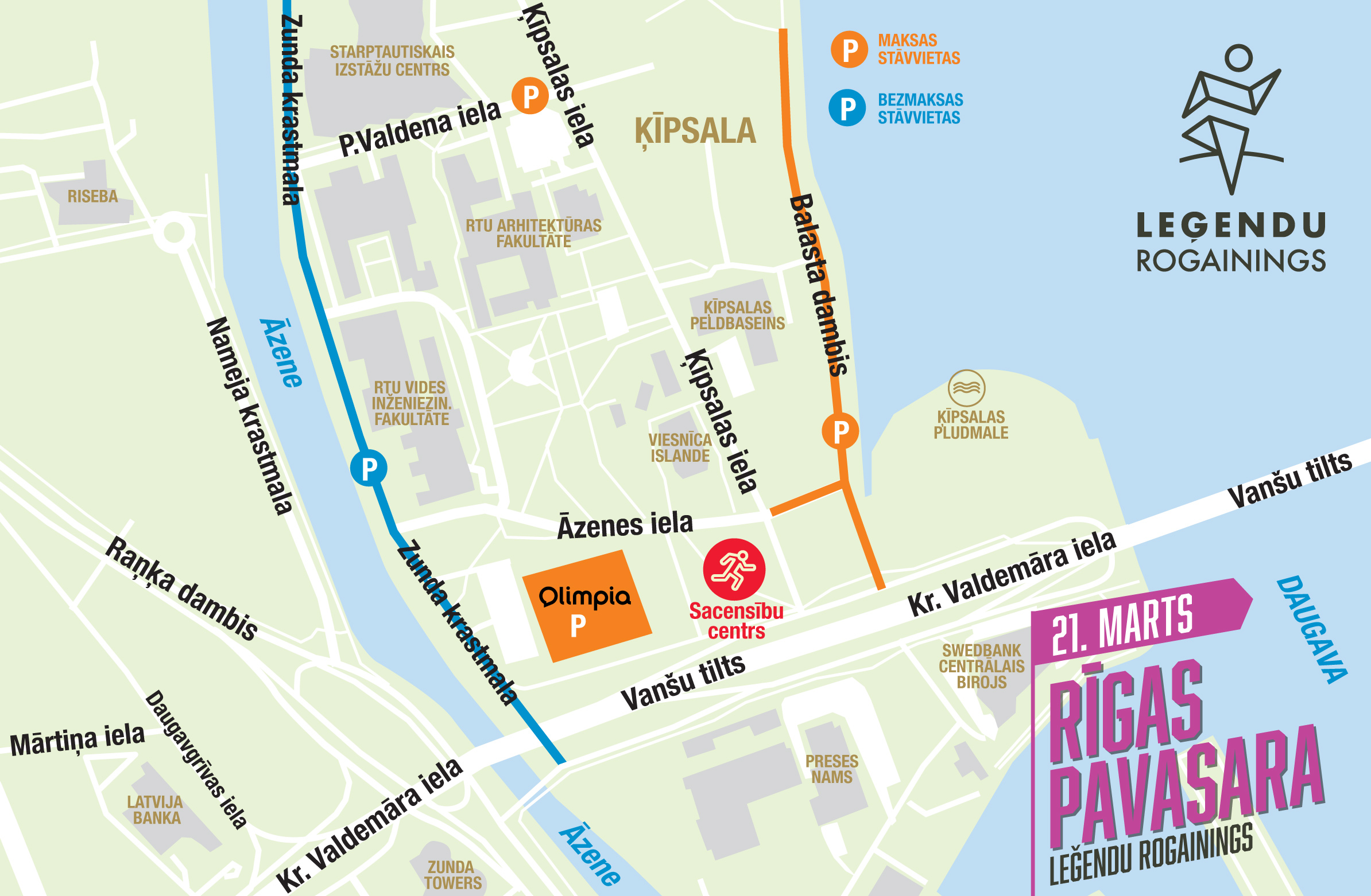
Parking: At the I/C Olimpia parking lot, cars can be parked for free for the first 3 hours, after which the price is 2 EUR/H. In Kipsala, it is possible to park cars for free on the surrounding streets or in the nearby RTU and Kipsala Hall parking lots for 3 EUR per day. See the precise map here. Payment in these parking lots is via Mobilly.
FIND A TEAMMATE!
Rogaining is a strategic team orienteering event where planning and a shared adventure are an essential part of success. So that no one has to stay home just because they are missing a partner, this season we have created a special platform for finding teammates.
How does it work? Join our official Facebook group, write a post about your planned distance and pace, and head out on the course with new teammates!
Find teammates here: facebook.com/groups/rogainings
Map Symbols
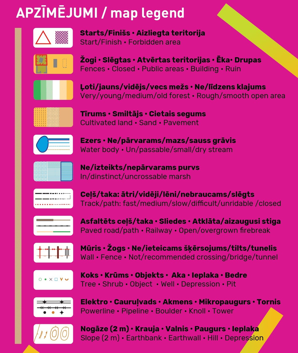 Since MTB is available in all stages this year, the map will differentiate asphalt (brown) and unpaved fast/medium/slow/very slow (the more dashed, the slower) black roads and trails. Narrow tractor ruts shown with the thin stiga symbol are unsuitable for cyclists, though runners may squeeze through.
Vegetation is shown with gradual transitions from very young to young, medium and old forest using four shades (green to white). Unlike classic orienteering maps, this describes forest age, not runnability. This detailed vegetation is possible thanks to the Latvian Geospatial Information Agency’s LiDAR data.
Remember that olive green areas are out of bounds. Closed roads are coloured red. If you see “Private property” signs in the terrain, please respect them even if not mapped.
Contours are at a detailed 2 m interval.
QuIZ Checkpoints for leisurely folks
 This is especially recommended for Hike and Children's Walk participants, but all other participants are welcome to use it too. If you are less concerned about achieving your best time or maximum points, but you enjoy stopping and noticing interesting things around – pay attention to the closest 15 checkpoints marked with asterisk * (numbered from 10 to 34) where you can find answers to questions about your surroundings.
Scan this QR code or click ej.uz/legendars (this form will be open on the race day at 9:30). In every checkpoint tap the correct answers. If the form accidentally closes – reopen it and find all your previous answers autosaved. At the finish don't forget to tap the button "Submit". Please submit your answers before the last cutoff time (at 17:00)!
Registered participants who will collect the most correct answers will automatically qualify for the prize lottery which will take place after the award ceremony of all rogaining winners.
If you want to preview the demo version – please click here: ej.uz/legendarsdemo
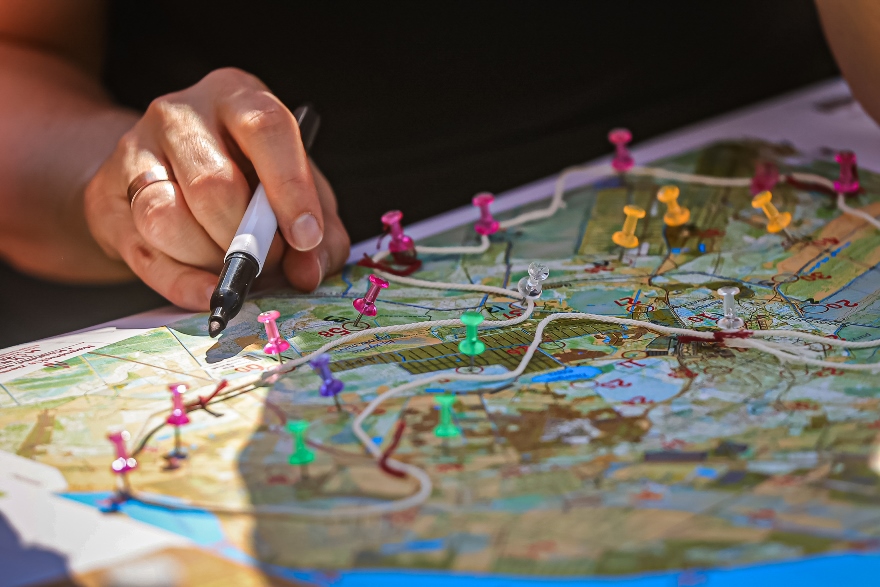
COMPETITION MAP AND TERRITORY
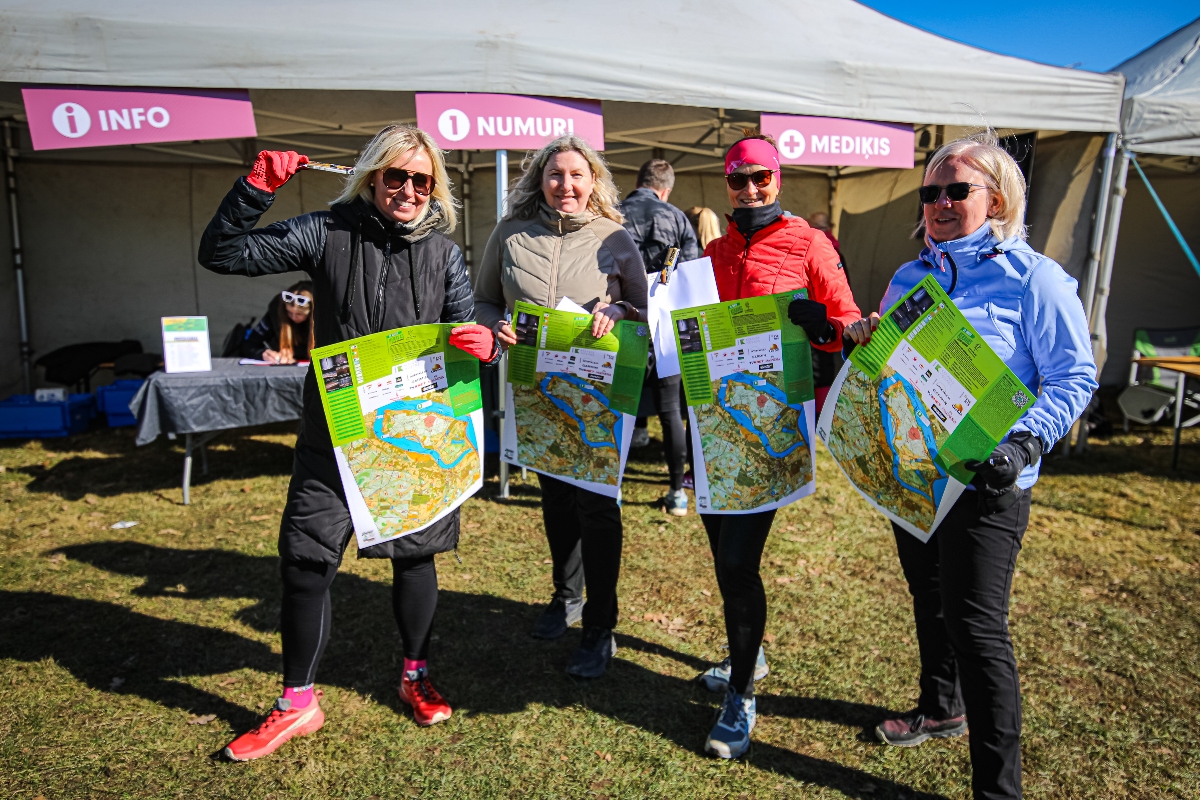
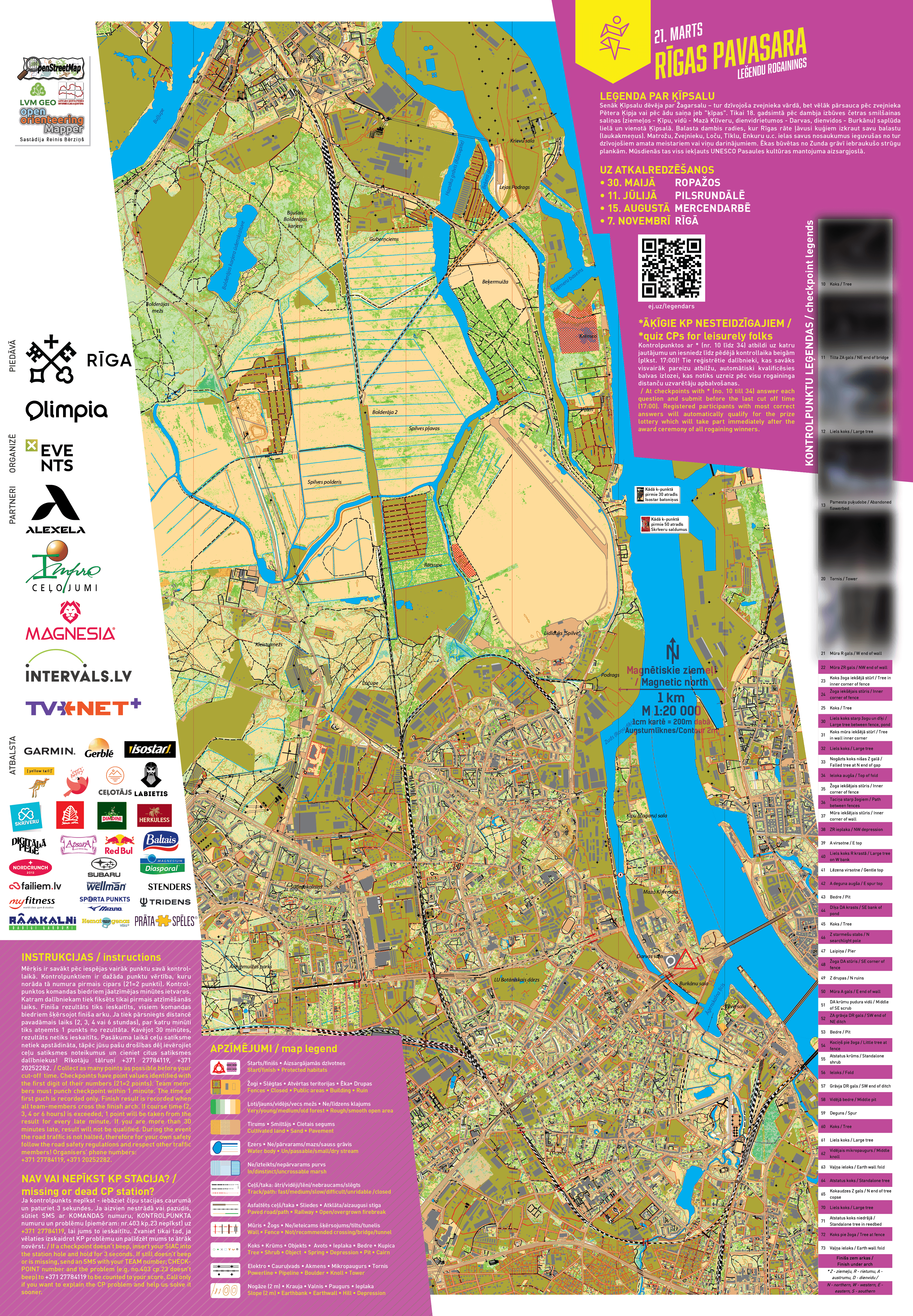
Maps will be distributed on the morning of the event. They are laminated but moisture may still enter from the edges. Long-distance participants are advised to reinforce map edges with tape or use waterproof map holders. Scale: 1:20 000 (1 cm = 200 m). Size: 62 × 43 cm.
The terrain consists mainly of runnable pine forests and sandy dunes. Most roads crossing dunes turn sandy and unrideable for cyclists (though parallel micro-tracks may exist). The map marks many such unrideable areas with thin stiga symbols. Lower wetlands contain dense shrubs and marsh vegetation, though after prolonged dry periods they may be more passable.
Control Point Descriptions
Study the control point descriptions! They clarify exact locations—north/south side of a building, etc. Some points are so legendary we encrypted the descriptions to avoid spoilers. You can try guessing them now, but the correct answers will be revealed on race day when you receive the map. Available for download as XLSX file.
| Nr. | Kontrolpunkta vieta / Checkpoint location |
| 10 | Koks / Tree |
| 11 | Tilta ZA gals / NE end of bridge |
| 12 | Liels koks / Large tree |
| 13 | Pamesta puķudobe / Abandoned flowerbed |
| 20 | Tornis / Tower |
| 21 | Mūra R gals / W end of wall |
| 22 | Mūra ZR gals / NW end of wall |
| 23 | Koks žoga iekšējā stūrī / Tree in inner corner of fence |
| 24 | Žoga iekšējais stūris / Inner corner of fence |
| 25 | Koks / Tree |
| 30 | Liels koks starp žogu un dīķi / Large tree between fence, pond |
| 31 | Koks mūra iekšējā stūrī / Tree in wall inner corner |
| 32 | Liels koks / Large tree |
| 33 | Nogāzts koks nišas Z galā / Falled tree at N end of gap |
| 34 | Ieloka augša / Top of fold |
| 35 | Žoga iekšējais stūris / Inner corner of fence |
| 36 | Taciņa starp žogiem / Path between fences |
| 37 | Mūra iekšējais stūris / Inner corner of wall |
| 38 | ZR ieplaka / NW depression |
| 39 | A virsotne / E top |
| 40 | Liels koks R krastā / Large tree on W bank |
| 41 | Lēzena virsotne / Gentle top |
| 42 | A deguna augša / E spur top |
| 43 | Bedre / Pit |
| 44 | Dīķa DA krasts / SE bank of pond |
| 45 | Koks / Tree |
| 46 | Z starmešu stabs / N searchlight pole |
| 47 | Laipiņa / Pier |
| 48 | Žoga DA stūris / SE corner of fence |
| 49 | Z drupas / N ruins |
| 50 | Mūra A gals / E end of wall |
| 51 | DA krūmu pudura vidū / Middle of SE scrub |
| 52 | ZA grāvja DR gals / SW end of NE ditch |
| 53 | Bedre / Pit |
| 54 | Kociņš pie žoga / Little tree at fence |
| 55 | Atstatus krūms / Standalone shrub |
| 56 | Ieloks / Fold |
| 57 | Grāvja DR gals / SW end of ditch |
| 58 | Vidējā bedre / Middle pit |
| 59 | Deguns / Spur |
| 60 | Koks / Tree |
| 61 | Liels koks / Large tree |
| 62 | Vidējais mikropaugurs / Middle knoll |
| 63 | Vaļņa ieloks / Earth wall fold |
| 64 | Atstatus koks / Standalone tree |
| 65 | Kokaudzes Z gals / N end of tree copse |
| 70 | Liels koks / Large tree |
| 71 | Atstatus koks niedrājā / Standalone tree in reedbed |
| 72 | Koks pie žoga / Tree at fence |
| 73 | Vaļņa ieloks / Earth wall fold |
| Finišs zem arkas / Finish under arch | |
| * Z - ziemeļu, R - rietumu, A - austrumu, D - dienvidu / N - northern, W - western, E - eastern, S - southern |
|